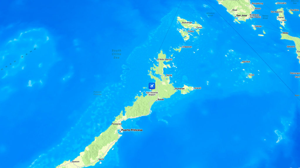
We’re headed to Palawan, an archipelagic province here in the Philippines, situated in the region of Mimaropa. We’re flying in via the San Vicente Airport in the municipality of San Vicente. San Vicente lies on Palawan’s northwestern shore facing the South China Sea. (Please refer to the map above.) The municipalities of Taytay and Puerto Princesa City border it northeast and south.
It was raining when we got there. We were relieved that there weren’t any weather systems that would have disrupted our flight from Metro Manila.
Now for some work-free time!
Here are a few photos. Click for a bigger view.


One thought on “San Vicente Airport, Palawan”
Comments are closed.